Situated at elevations ranging from 1,100 to 2,031 meters above sea level on the Titiwangsa Range, Cameron Highlands is Malaysia’s most extensive hill station. Beyond its colonial history and agricultural importance, the region is a critical ecological site featuring rare montane cloud forests, mossy forest ecosystems, and a high concentration of endemic flora and fauna.
ECOLOGICAL HIGHLIGHTS
- The Mossy Forest: Located on the ridges of Gunung Brinchang, this high-altitude evergreen forest is characterized by a constant shroud of mist and tea-colored peat. The trees are draped in thick layers of moss, lichens, and liverworts, creating a unique microclimate for carnivorous pitcher plants (Nepenthes) and wild orchids.
- Gunung Brinchang: At 2,031 meters, it is the highest point in the highlands accessible by road. The summit offers a vantage point of the surrounding dipterocarp forests and the rugged landscape of the Pahang-Perak border.
- Wildlife Sanctuary: Gazetted as a Wildlife Sanctuary in 1962, the remaining primary forests provide a refuge for montane bird species, including the Mountain Peacock-pheasant and various species of laughingthrushes and warblers.
COMMUNITY & LANDSCAPE
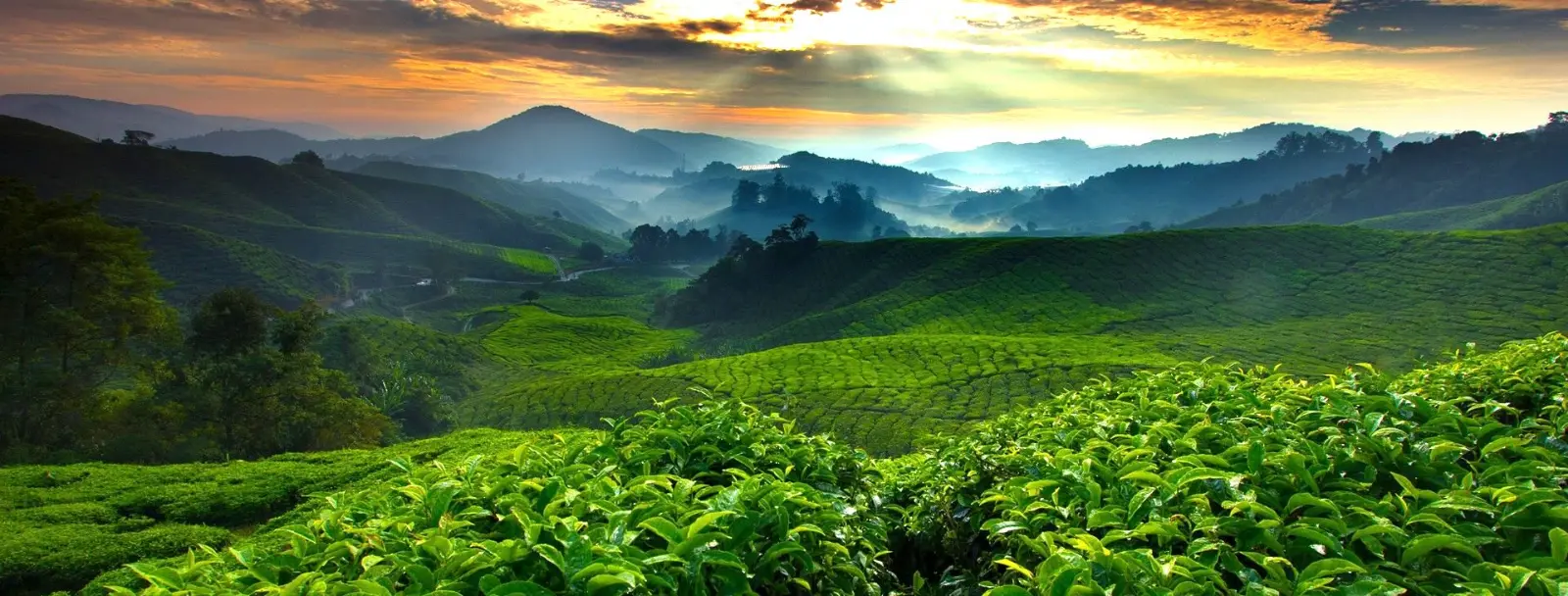
- Agriculture & The "Green Bowl": The highlands are the primary source of temperate produce for Malaysia and Singapore. The terraced slopes of Tanah Rata and Brinchang are dominated by tea plantations, strawberry farms, and flower nurseries, reflecting the region's fertile volcanic-adjacent soil.
- Townships: The area is comprised of three main townships: Ringlet, Tanah Rata (the administrative and trekking hub), and Brinchang. Each offers a blend of local markets and colonial-era architecture.
TREKKING & HIKING
Cameron Highlands features a well-established network of jungle trails, originally blazed during the colonial era.
- Leisure Trails: Routes such as Trail 4 (Parit Falls) offer accessible walks through secondary forest and bamboo groves.
- Advanced Treks: Trails leading to Gunung Berembun and Gunung Jasar provide a more challenging experience through primary montane forest, showcasing the transition of vegetation with increasing altitude.
PRACTICAL INFORMATION
- Access: The highlands are accessible via two main routes from the North-South Expressway: the traditional winding road via Tapah (Route 59) or the wider, more gradual ascent via Simpang Pulai (Route 185).
- Climate: Temperatures typically range between 15°C and 25°C. The region experiences higher rainfall from October to November, while the dry season from February to April is ideal for trekking and birdwatching.
- Conservation Note: Visitors are urged to stay on marked trails to protect the fragile mossy forest floor and avoid the collection of wild plants.
Experience Malaysia’s Premier Nature Destinations
Langkawi Signature Nature Tours:
Planning a visit to the Jewel of Kedah? Explore Southeast Asia’s first UNESCO Global Geopark with the archipelago's leading naturalists. From rainforest treks to ethical mangrove boat safaris, we provide world-class field interpretation.
Explore Tours: Langkawi Nature Expeditions
General Reservations & Inquiries:
Hotline (WhatsApp): +60 19 225 2300
Email: junglewalla@gmail.com
Corporate & Media:
Azri Hussein (Operational Manager)
WhatsApp: +60 19 592 2300